“That’s what Balaguer did,” Don Chencho, a character who embodied the simple man, said with conviction during the Reformist Party’s 1986 election campaign, when Balaguer wanted to return to the power he had lost in 1978. He appealed to the aggressive, constructive policies of the 12-year period
SANTO DOMINGO. – At the Duarte Bridge crossing, on April 27, 1965, the constitutionalist civilian faction halted the advance of the military forces that had the support of troops from the Organization of American States and the United States.
That place, at the entrance to Villa Francisca, was one of the most active scenes of the April War and one of the first urban renewal projects of the Balaguer government was precisely there: the construction of the Plaza de la Trinitaria, in front of the Duarte bridge.
Natalia Ulloa Cáceres, citing research on the historical memory of the sector, points out that this beautification construction was intended to erase the memory of the place, creating a new image at the entrance to the city, delimited by residential buildings of four to five stories, enough to hide the neighborhoods of the sector from view, establishing a kind of scenario in which poverty is not eliminated but hidden.
The April War had played a prominent role in the working-class neighborhoods of the capital, especially in Villa Francisca, a fact that the authorities did not forget, and the fact that Balaguer's first major urban renewal operation had that very place as its starting point, points to something about the political nature of what was presented as housing and urban modernization policy.
And it was a pattern that, throughout the 1970s, became a state program. The government launched the so-called Emergency Plan, which aimed to achieve the urban transformation of the capital, and the methodology was consistent: demolition of shantytowns, construction of avenues over the existing fabric of working-class neighborhoods, and building of new buildings along the sides of the new roads. These buildings, which created a visual barrier between the new avenues and the remaining marginalized neighborhoods that were left untouched, became popularly known as "walls of shame.".
Ulloa Cáceres documents that working on the basis of eliminating existing housing created the need to rehouse families, thus diminishing the impact of these new constructions on reducing the quantitative housing deficit. Rather than eliminating the housing deficit, the policy had hygienic objectives and the purpose of creating a new image to transform the capital into the perfect postcard of the country's development.
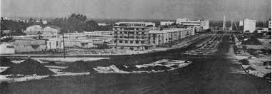
27 de Febrero Avenue was one of the axes of that transformation. Its route crossed the Villa Francisca sector, a working-class neighborhood whose participation in the civil war had made it a symbol of popular resistance.
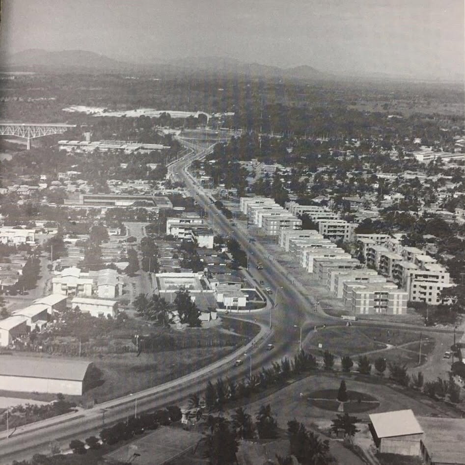
The apartment blocks built along that avenue included commercial premises on the ground floor, taking advantage of their location in an area of high commercial activity, and the resulting image was modern on the outside and hid behind it the remaining fabric of a neighborhood whose habitability problems, as Ulloa Cáceres points out, decades later not only continued to exist but tended to worsen.
The General Antonio Duvergé neighborhood, popularly known as Honduras, offers another perspective on the period. It was designed in 1968 by architect Rafael Thomas Hernández as part of Balaguer's development policy and was located along Independencia Avenue, south of Mirador Sur Park.
Its urban layout featured large blocks of varying shapes and proportions arranged around central spaces reserved for public facilities. It combined collective housing typologies in three- and four-story buildings with open spaces that, in their original state, formed a kind of neighborhood park.
Ulloa Cáceres' doctoral thesis includes a detailed analysis of the state of the neighborhood forty years after its construction, using General Antonio Duvergé as a case study on the possibilities and limitations of intervening in the existing built park.
The geography of that renewal also had a logic of social segregation that was explicit although rarely acknowledged in official discourse.
Ulloa Cáceres points out that the urban development of the period created a city in which social classes began to settle in differentiated areas, resulting in a segregation that the regime did not see as a problem but as a natural consequence of development.
While the private sector was building for the middle and upper classes in new areas like NACO, which introduced the North American suburban model to Santo Domingo with its first large urbanization on part of the grounds of the old General Andrews airport, the State was building public housing on demolished popular neighborhoods, relocating their inhabitants to conditions that often did not improve on those they had before.
The writer and activist Mike Davis, in his book Planet of Slums, compared Balaguer's urban operations to the transformation that Baron Haussmann carried out in 19th-century Paris: in addition to monumentalizing himself, Balaguer wanted to "Haussmannize" the traditional enclaves of urban resistance.
“Their main target was Sabana Perdida, a huge low-income area northeast of the city center.” The quote is taken from researchers who worked directly in that area and documented that the plan was to get rid of problematic elements in the upper city’s working-class neighborhoods by relocating them to the outskirts, in a context where memories of the 1965 revolution (and the 1984 riots later on) suggested that it would be convenient to eliminate the center of political protest and opposition.
Urban planner Amparo Chantada, a specialist in urban geography with extensive experience in studying the capital's reality, analyzed the collateral effects of this renovation on the rest of the territory: the government moved poverty to the outskirts of the cities, built luxury apartments for its officials, and adapted the urban space of financial capital on the central lands occupied by humble sectors.
The capital, Chantada concluded, as quoted by Ulloa Cáceres, grew by more than ninety square kilometers as a result of those operations.
Series: History of social housing in the Dominican Republic. (Chapter VIII).
Recommended readings: