


Using photographs verified and geolocated by EL PAÍS, from Spain, a comparison is made of what some of the buildings, homes, schools and hospitals that have been attacked by Russia looked like
Taken from El País
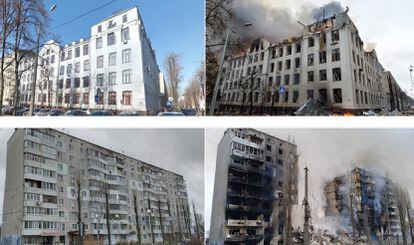
After more than two weeks of war, Ukraine is a completely different country from the one where “almost everything was celebrated,” as journalist Margaryta Yakovenko recounts in a podcast describing life for Ukrainians before the bombs. The state of the houses, roads, hospitals, and schools reveals the devastating impact of Russia's invasion across the country. Photographs verified and geolocated by EL PAÍS, a Spanish newspaper, illustrate the before and after.
Irpin residential neighborhood
In early March, the city of Irpin, about 25 kilometers from the Ukrainian capital, Kyiv, was targeted by Russian bombing. Among the numerous buildings damaged by the attacks, residential apartment blocks stand out. The image shows the devastation caused by bombs on an apartment building that fell on March 3rd.

Borondianka Residential Building
A Russian attack in early March leveled the central half of an apartment block in Borondianka, in the Kyiv region. In front of it stands a bust of Taras Shevchenko, one of Ukraine's most famous writers and a national symbol.

Mariupol residential area
These satellite photographs, distributed on March 9 by Maxar, show devastated homes in Mariupol, one of the hardest-hit cities. Some of the most shocking images of the Russian invasion have been those resulting from the attack on a maternity and children's hospital in that city.

Faculty of Economics, Karmazin University, Kharkiv
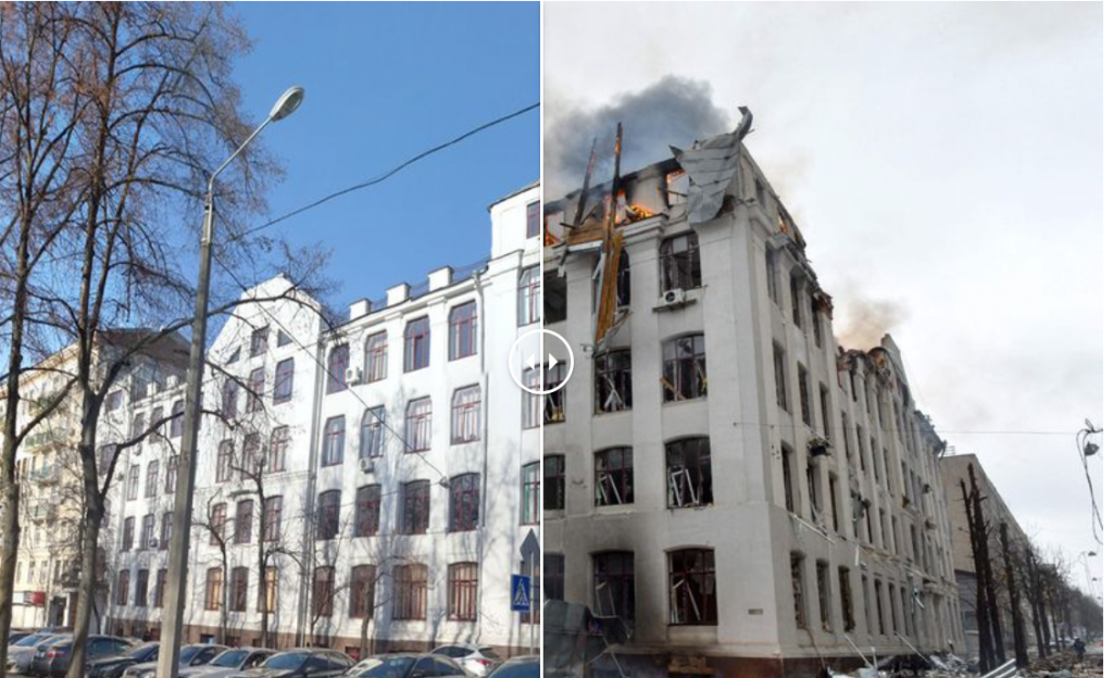
Following the attacks that Kharkiv suffered during the first week of March, many emblematic places in the city suffered damage, including the Faculty of Economics of the University of Kharkiv, which we can see in flames in the image.
Kharkiv Regional Administration Building
On March 1, Russian attacks reached one of Kharkiv's most vibrant squares, Freedom Square, surrounded by offices and bars. The regional administration building is visible in the image.

Freedom Square, in Kharkiv
The center of Kharkiv, including the vehicles that were in it, like the one seen in the following image, were reduced to rubble during the Russian attacks on the country's second city.

Kharkiv School No. 134
The bombs that fell on Kharkiv in late February hit specialized school number 134, located very close to the city center. The images available on Google Street View showing what the school looked like are from June 2015, which explains why some details of the facade, such as the signage, are not identical to the current image.

Izium Hospital
In Izium, in the Kharkiv region, a hospital was destroyed on March 8 following a Russian attack. Ukraine's Deputy Foreign Minister, Emine Dzheppar, stated on social media that the hospital had been operating in the days prior, treating wounded patients.

School in Zithomir
On March 4, one of the schools in Zhytomyr, 150 kilometers from Kyiv, was destroyed in a Russian attack. The signs bearing the school's name and number, 25, do not match because the Google Street View images are from 2018.