

Yesterday afternoon, Monday, there was various damage to the roads of the Dominican capital due to the winds caused by the phenomenon .
SANTO DOMINGO– An active trough continues to affect several provinces across the country, causing moderate to heavy downpours with possible hail, thunderstorms, and gusty winds. Therefore, the Dominican Institute of Meteorology (INDOMET) maintains its weather alerts for Tuesday, April 14.
According to the latest report from the agency, issued at 6:00 pm yesterday, April 13, the effects of the trough will remain mainly in the afternoon, causing cloud cover increases accompanied by moderate to heavy downpours at times, thunderstorms and gusts of wind over different locations in the country.
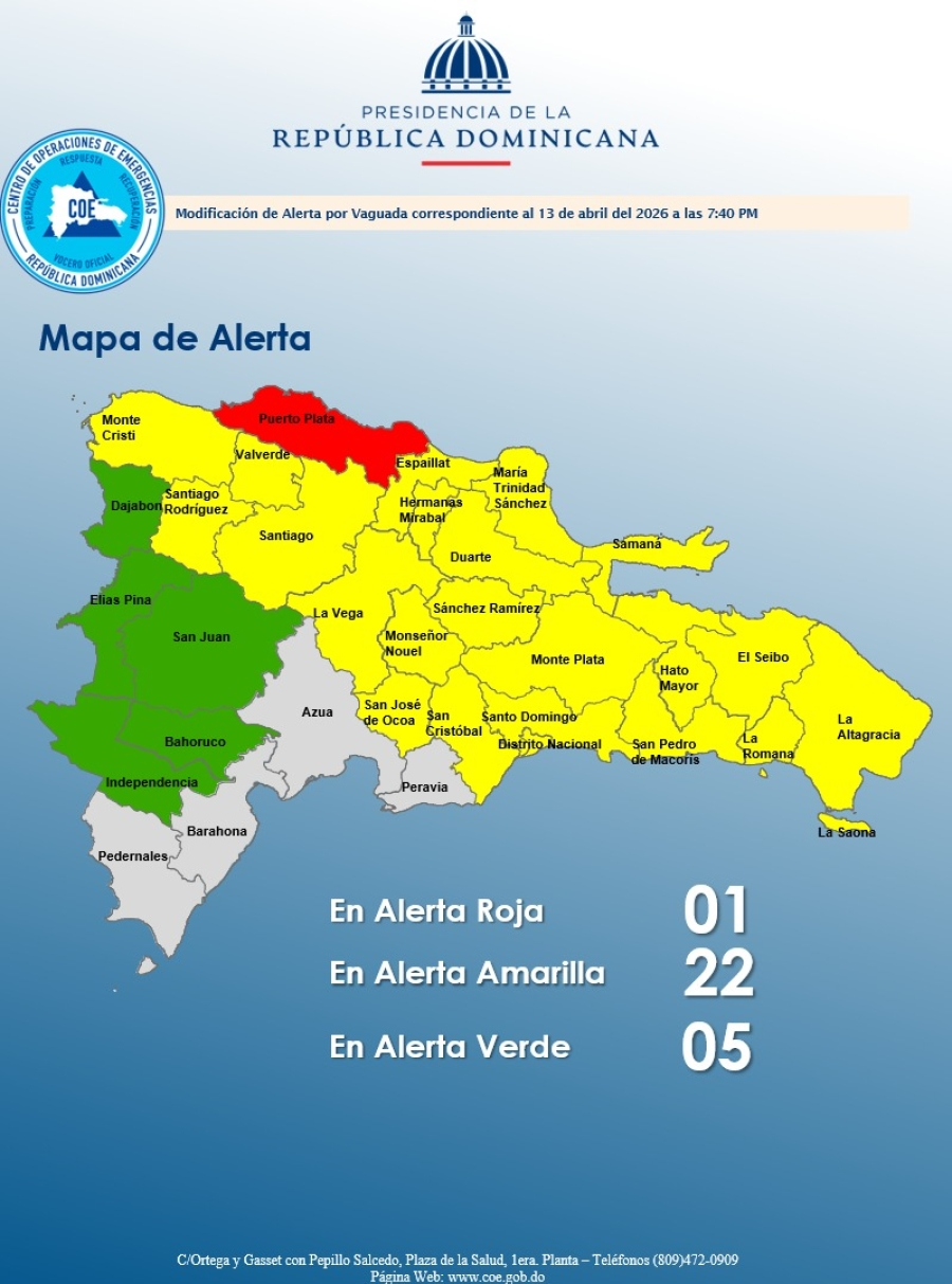
According to the report, weather warning and alert levels remain in effect in 27 provinces across the country.
For its part, the Emergency Operations Center (COE) maintains one province on red alert, 22 on yellow alert and 5 on green alert:
Red alert:
Puerto Plata
The provinces under yellow alert:
Monsignor Nouel
Sánchez Ramírez
Santiago
La Vega
Monte Cristi
Samaná
La Altagracia
National District
Santo Domingo
Santiago Rodríguez
San Pedro de Macorís
Hermanas Mirabal
Duarte (especially the Lower Yuna)
San José de Ocoa
La Romana
El Seibo
Espaillat
Valverde
Monte Plata
Hato Mayor
San Cristóbal
The provinces on green alert:
Bahoruco,
San Juan
Elías Piña,
Dajabón
Independencia
The agency recommends that people refrain from crossing rivers, streams and ravines with high water levels and avoid using swimming areas in the provinces under alert.
Similarly, INDOMET recommends that fragile, small and medium-sized vessels navigate with great caution near the coastal perimeter without venturing out to sea, due to abnormal wind and waves.
Also, frequent episodes of reduced visibility due to heavy rain, electrical discharges, very strong gusts of wind and even possible waterspouts.
Recommended readings: